fr
frHiking with the family is a great way to connect with nature and have a special time with your loved ones.
Yes, but sometimes its too sporty and physical aspect makes this activity discouraging.
That's why lakes are often a good argument to motivate the troops.
Reaching them is often the goal. A playful and refreshing side for young and old.
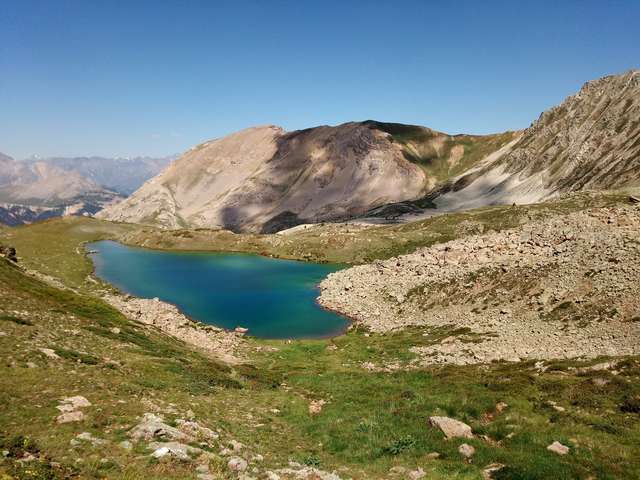
The majestic snow-covered peaks begin to melt in the spring, releasing large quantities of water, some of which accumulates in hollows forming these mountain lakes of so many different colours, shapes and sizes.
More than 40 high altitude lakes await you in the High Valleys! There is something for all levels, with between 20 minutes and 5 hours walk to reach them.
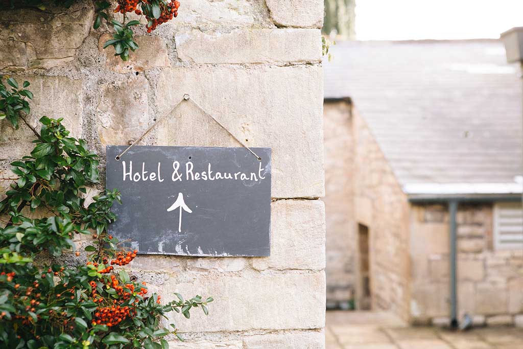
The Valley of Serre-chevalier and its surroundings, situated in the heart of the southern Alps in the department of the Hautes Alpes, offers us some of the most beautiful mountain walks.
With its different valleys such as the Serre-chevalier, Queyras, Clarée, and Grave, the north of the department is home to a resplendent and wild nature far from the hustle and bustle, with a multitude of peaks, meadows, torrents and lakes.
In this description, I propose you a small selection of hikes to do with your family with young children or simply for a gentle restart before other more sportive hikes.
"It's an easy hike that's mostly in the forest."
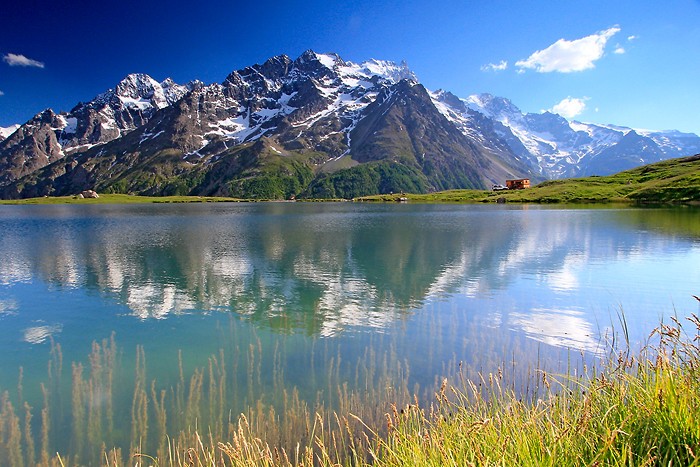
The Lac de la Douche is probably the "family hike" of the Serre-Chevalier valley.
This lake is located in the heart of the Ecrins National Park with its famous "barre des écrins" (a bar in the Ecrins) culminating at 4101 meters.
Its milky blue colour comes from the melting of the glaciers.
To go to the Lac de la Douche you will have to go to the small hamlet of Le Casset located in the commune of Monêtier-les-Bains.
When you arrive from briançon you can park on a large car park at the entrance of the village. From there you will walk through the village passing successively in front of the old mill, the church as well as "chez finette", a renowned restaurant in the valley with its authentic cuisine in a warm and relaxed atmosphere. A little further on you will cross the Guisane on the last bridge of the village, on the GR 54.
From here you just have to follow the yellow signs indicating this hike.
You will go up along the torrent of the Petit Tabuc in a forest of larches which is very pleasant on hot days. The slope is gentle and regular which makes this excursion so accessible.
In the line of sight, in the background, stands the mountain of the Lambs with in the foreground the glacier of the casset which feeds the Petit Tabuc.
A little more effort and you will be there.
Don't hesitate to go up on the right towards the Col d'Arsine to get a little higher and admire the postcard-like panorama: lake, summits and eternal snow.
After a good stop, the return journey is by the same path as on the outward journey.
Main information:
Map IGN: 3436ET Meije Pelvoux Parc des Ecrins
Minimum altitude: 1512 m
Maximum altitude: 1901 m
Distance: 7.9 km round trip
Round trip time: 2h20 .
Beaconing: many indications of the G.R.
More practical information: http://www.oduch.fr/Randonnee/Lac-de-la-Douche
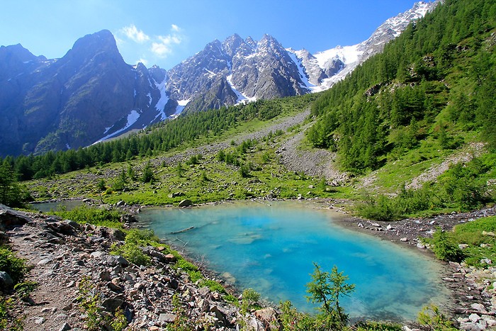
Lac Vert is located in the narrow valley on the commune of Névache in the Clarée valley.
Its specific colouring (green) is due to the presence of algae covering its bottom, as well as its shallow depth.
Entirely surrounded by forest, the lake is dotted with dead trees criss-crossing each other, which adds to the picturesque character of the site.
The lake was Italian until 1947 but by the Treaty of Paris it became French and was attached to the commune of Névache.
From Briançon, take the Clarée valley via the D994. Turn right 2Km before Névache to continue towards the Col de l'Echelle which you will cross.
Go down again and before crossing the Italian border, turn left to follow the road that will take you to the terminus.
You can park at Les Granges, in the heart of the Vallée Étroite.
From Les Granges de Vallée Etroite, follow the road by the Pont de la Fonderie. About one kilometre further on, take the path on the right (direction East) and cross the Vallée Etroite stream. After the bridge, take the path that goes straight up into the forest and leads in 5 minutes to a small lake hidden by a few trees at the foot of the scree of the Kings Magi.
A hike with an Italian accent due to its quicker access from the side of our neighbours.
After making the tour, the return trip can be done by the same path.
Main information:
Map IGN : 3535OT - Névache
Minimum altitude: 1708 m
Maximum altitude: 1886 m
Distance: 4.80 km round trip
Round trip time: 1h25
Beaconing: numerous indications from the G.R.
More practical information: http://www.oduch.fr/Randonnee/Lac-Vert
From Briançon, take the direction of Serre Chevalier, at Saint Chaffrey, go up to the Granon pass where you park in a large car park. A small refreshment bar is set up during the summer period.
This high-altitude lake is easily accessible because of the possibility of parking at an altitude of over 2000 metres.
You will evolve in a high mountain atmosphere, where the trees that no longer grow leave room for rocks and grasses.
When you reach the Granon pass, on your left, a path starts. It is on the GR 7 from where you will reach the Col de l'Oule in an hour by a very good path. During the ascent on your left you will be able to admire two magnificent summits, the Grand and the Petit Aréa. From the col, you descend to the lake of L'Oule, 120 meters below. The return is by the same path. You will enjoy the view with the Ecrins National Park in front and its eternal snows.
The advantage of this hike is to split the ascent in two: you will go up a little less than 150 meters and then you will enjoy a descent to the lake, on the way back you will do the same, a small ascent, then a descent.
The Col du Granon is on the ridge line that delimits the Guisane and Clarée valleys.
Main information:
IGN Map: 3436ET Meije Pelvoux Parc des Ecrins
Minimum altitude: 1512 m
Maximum altitude: 1901 m
Distance: 7.9 km round trip
Round trip time: 2h20 .
Beaconing: many indications of the G.R.
More practical information:
https://www.milierando.fr/le-lac-de-l-oule-saint-chaffrey-briancon-05-nouceau
The shoe lake is by foot!
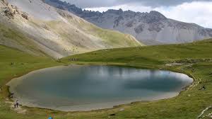
The lake is located under the ridges of Côte Belle and des Oules, near the Crête du Tronchet, and is dominated by the Pic de Roche-Brune.
Surrounded by beautiful green lawns (pastures of cows and sheep in summer pastures), very easily accessible, almost perfectly round in shape (hence its nickname "eye of Queyras"), the Lac de Souliers is overhung by its characteristic cross.
To get to the start of this hike, from Briançon take the direction of Cervières and then the Col de l'Izoard.
At the top of the pass you will continue by going down on the Queyras side for about 3 km, crossing the impressive scree of the Case Déserte.
You will find on your right a parking lot with an orientation table.
From here you can find the hiking trail on the GR 58, it starts in the forest with beautiful shady areas and gradually a panorama of the Arvieux valley. The slope remains regular and without much difficulty.
Halfway out of the forest, after a short descent, you will arrive at the PR/GR junction sign. Leave the right-hand path GR58 horizontal which allows you to reach the Col du Tronchet: take the left-hand path (yellow PR markings) which goes up the coomb and allows you to reach the Lac de Souliers.
There you are!
You will be charmed by the contrast between the green slopes and the gypsum cliffs of the surrounding crests, and by the view of the Arvieux valley, the Queyras summits and Mont-Viso.
The return journey is by the same path.
Main information:
IGN Map: 3537 OT
Minimum altitude: 2212 m
Maximum altitude: 2492 m
Distance: 4.9 km round trip
Round trip time: 1 hour 40 minutes.
Beaconing: numerous indications of the G.R. and the lake.
More practical information: https://www.envie-de-queyras.com/guide/lac-de-souliers-arvieux
Beautiful lake above the hamlet of Les Cours, near Villar d'Arêne. You can get close to it by car, but you can walk from Les Cours through the fields by a nice little road where you might see marmots.
Leaving Briançon in the direction of Grenoble, you will go up to the Col du Lautaret and go down a few kilometres before turning right towards the hamlet of Les Cours.
When you reach the top of the col du lautaret you will find yourself facing glaciers that will literally transport you into another universe.
It is now the Romanche valley that you will discover, a few kilometres further on, the mythical ski resort of La Grave.
Do not pass Villar d'Arêne but park just before the sign for the hamlet of Les Cours on the right-hand side of the road.
A crossroads in the village indicates the lake on the left, turn right as this will be the downhill route. At the top of the village another sign indicates the lake. If possible, keep going uphill, the path is sometimes little marked.
Go past a wash-house and past the chapel.
At the second wash-house and at the signpost, turn and go up to the left in the direction of the lake of Pontet and Aiguillon.
20 m further on, turn right and take the wide driveway again heading east.
Meeting a second sign indicating the direction of the Lac du Pontet, do not follow this direction which will be partly used for the return journey but take the wide driveway on the right.
Around 1900m of altitude, pass the few houses of Chazelet.
Join the stream a little higher up, it is the one that comes down from the lake, which is quickly reached.
The glacier of La Meije is a bit masked by the Bec de l'Homme glacier, but the view is no less impressive.
A small refreshment bar is set up on the edge of the lake in summer.
Go around the lake.
The descent can be done by the classic path.
Join the small road leading you back to the hamlet.
Main information:
Map IGN: 3435 ET : Valloire Aiguilles d'Arves Col du Galibier
Departure altitude : 1750 m
Altitude of the highest point: 1982 m
Distance: 4.85 km
Beaconing: numerous indications
More info at: https://www.altituderando.com/Lac-du-Pontet-1982m
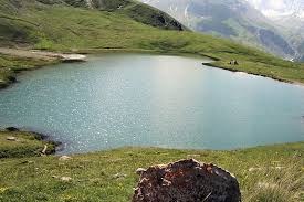
A fairly large lake that when there is no breeze, usually in the morning and evening, offers us a remarkable spectacle with its magical reflections, different according to the seasons.
The Orceyrette lake is located in the Ayes valley, within the Natural Biological Reserve of the Bois des Ayes (created in 1991). The beauty of the landscape and the calm that reigns there make it an unmissable site. It has even been chosen as a location for the filming of television series and films, including the TV series Alex Hugo.
The lake is of glacial origin, which means that it is the result of the retreat of the glaciers that once covered the whole of the Alps.
This nature reserve is characterized by a vast old forest of Cembro Pine (Pinus cembra), associated with European Larch (Larix decidua) in its lower part, which constitutes the largest and most remarkable cembra forest in the French Alps. The vegetation landscape consists of moors, subalpine meadows, alpine pastures and lawns, as well as wetlands.
From Briançon, you reach the lake in the direction of the chalets des Ayes from the village of Villar saint Pancrace by a recently asphalted road.
The road is not passable in winter.
You will cross the hamlet of Les Ayes a few more kilometres before arriving on a large plateau that looks like a natural campsite and picnic site called Plan de Peyron.
You can park your car, the hike will start from there.
Unless you wish to continue and you park directly at the lake which is also accessible by car.
Going up the Orceyrette torrent, at the end of the Plan Peyron you will find a small path that will take you directly to a lake of the Orceyrette.
This path continues and allows you to go around the lake.
You will be surrounded by beautiful mountain peaks, including the Pic de Peyre Eyraute (2903 m), the Crête des Pénitents, the Pic du Haut Mouriare (2808 m) (behind which is the Lac de l'Ascension), the Pic de Maravoise (2704 m) and the Pic des Chalanches (2779 m).
The return is done by the same path
Main information:
IGN Map: 3536OT
Minimum altitude: 1860 m
Maximum altitude: 1927 m
Distance: 3.5km round trip
Round trip time: 1h15 .
Beaconing: numerous indications
More practical information: https://www.envie-de-brianconnais.com/guide/lac-orceyrette